Bradford on Avon is a town of just over 10,000 people in west Wiltshire, close to the Somerset border and about eight miles south east of Bath.
It is built of honey-coloured limestone similar to Bourton and Bibury, it made its money the same way they did, and it is stacked up a hillside above a river in a way that makes it look, from certain angles, like an unusually large Cotswold village. And yet a good number of people will tell you it is not in the Cotswolds at all.
Is Bradford on Avon in the Cotswolds?
This is the kind of question that would spark heated debate in pubs in the days before you could just quickly Google the answer on your phone.
The clearest answer comes from the body that draws the map. The Cotswolds National Landscape’s own literature describes the Wiltshire portion of the Cotswolds as running from Bradford on Avon in the south to Kemble Airfield in the north. The town is the southern anchor of the whole thing.
The argument you will hear against it is that the town centre falls outside the protected boundary. That is true, and it proves nothing. Cirencester’s urban core is a hole in the boundary as well, and Cirencester calls itself the Capital of the Cotswolds without anybody objecting. The same applies to Bath, Cheltenham, Gloucester and Stroud. Large towns tend to get left out when a landscape boundary is drawn round them. Smaller towns and villages like Stow, Bourton and Painswick sit inside it.
What is really going on is county identity. Bradford on Avon is in Wiltshire, it is eight miles from Bath, and Bath’s gravity is strong enough to pull it into a different story. The stone is the same. The geology is the same Jurassic limestone belt. The wool money that built it is the same wool money.
As far as we’re concerned, it’s Cotswolds adjacent enough to be worth a feature.
The town the wool money built
Bradford on Avon was a cloth town, and the buildings still tell you which part of the trade paid for what.
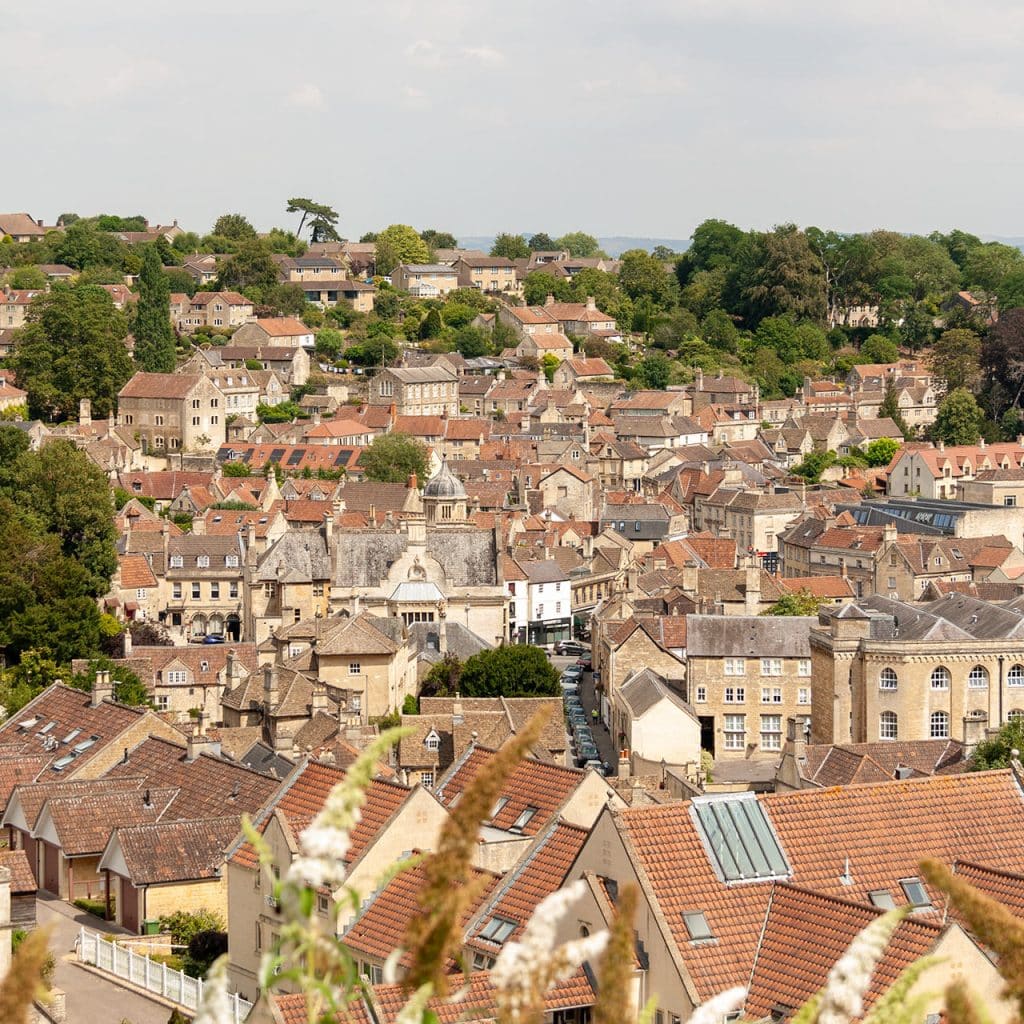
The hillside above the town centre was developed from the seventeenth century out of the Methuen manor estate, in three terraces stacked one above the other: Newtown at the bottom, Middle Rank in the middle, and Tory, also called Top Rank, along the top. Weavers’ cottages survive on all three. This is the part of town most visitors photograph from below and never actually walk up into.
At the top, level with the Tory terrace, is St Mary Tory, a fifteenth century chapel that stood on the pilgrim route towards Glastonbury. The name has nothing to do with politics: “tory” here comes from tor, a hill.
The town’s rubber industry started in 1848 at Kingston Mill, off what is now Kingston Road, where Stephen Moulton took over redundant woollen mills and brought vulcanised rubber to Britain. The Iron Duke, the calender machine he began with, has been restored and stands on Kingston Road as a memorial to it. The rest of that story is at The Hall, which Moulton bought in the same year.
Down in Church Street, Abbey Mill is a different mill with a similar arc. Parts of it are early nineteenth century and the big square block you see now is a rebuild of 1874-5. Cloth making stopped here in 1902 and the machinery was auctioned off to a Yorkshire firm. It was a billet for Australian soldiers in the First World War, then taken over by the George Spencer Moulton rubber company in 1915, converted to offices, and closed in 1995. It has been retirement apartments since 1997.
Things to do in Bradford on Avon
The Saxon church of St Laurence
For most of its life this building was not known to be a church.
A charter of King Æthelred granted Bradford to the nuns of Shaftesbury in 1001, and the architecture suggests St Laurence was built for them early in the eleventh century: tall, narrow, small windows, the shape a late Saxon church is supposed to be. William of Malmesbury records it standing in the 1120s. Then it disappears from the record. It was used as a school from 1715, absorbed into the buildings around it, and eventually abandoned.
In the nineteenth century repair work exposed two carved stone angels above what turned out to be the original chancel arch. Canon W H Jones, the Vicar of Holy Trinity and a serious historian, had already noticed that the building was taller than its neighbours and had the roofline of a church. He arranged its purchase and set up the trust that still looks after it.
It is one of very few Anglo-Saxon churches in England that was never rebuilt or medievalised, for the simple reason that nobody knew what it was.
The tithe barn at Barton Farm
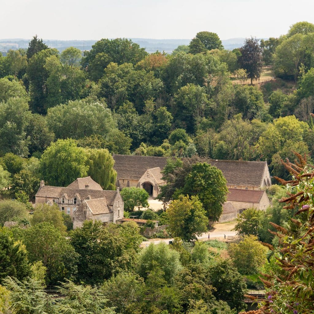
Ten minutes’ walk along the river, the tithe barn is one of the largest medieval barns in England and one of the finest anywhere. It was built in the middle of the fourteenth century for Barton Grange, a manor farm belonging to Shaftesbury Abbey, then the richest nunnery in the country.
It is 51 metres long, and the reason to go in is the roof: a cruck frame, essentially enormous curved tree trunks used as ribs, and one of the best surviving examples of the technique. The abbey was dissolved in 1539 and the barn carried on as part of a working farm until 1914.
It is English Heritage, free to go in, open daily 10.30am to 4pm, though it closes occasionally for local events. Day to day it is looked after by the Bradford on Avon Preservation Trust. Parking at the barn is limited and charged, because the car park is not English Heritage’s, and the town centre and station are both a short walk away.
The town bridge and the lock-up
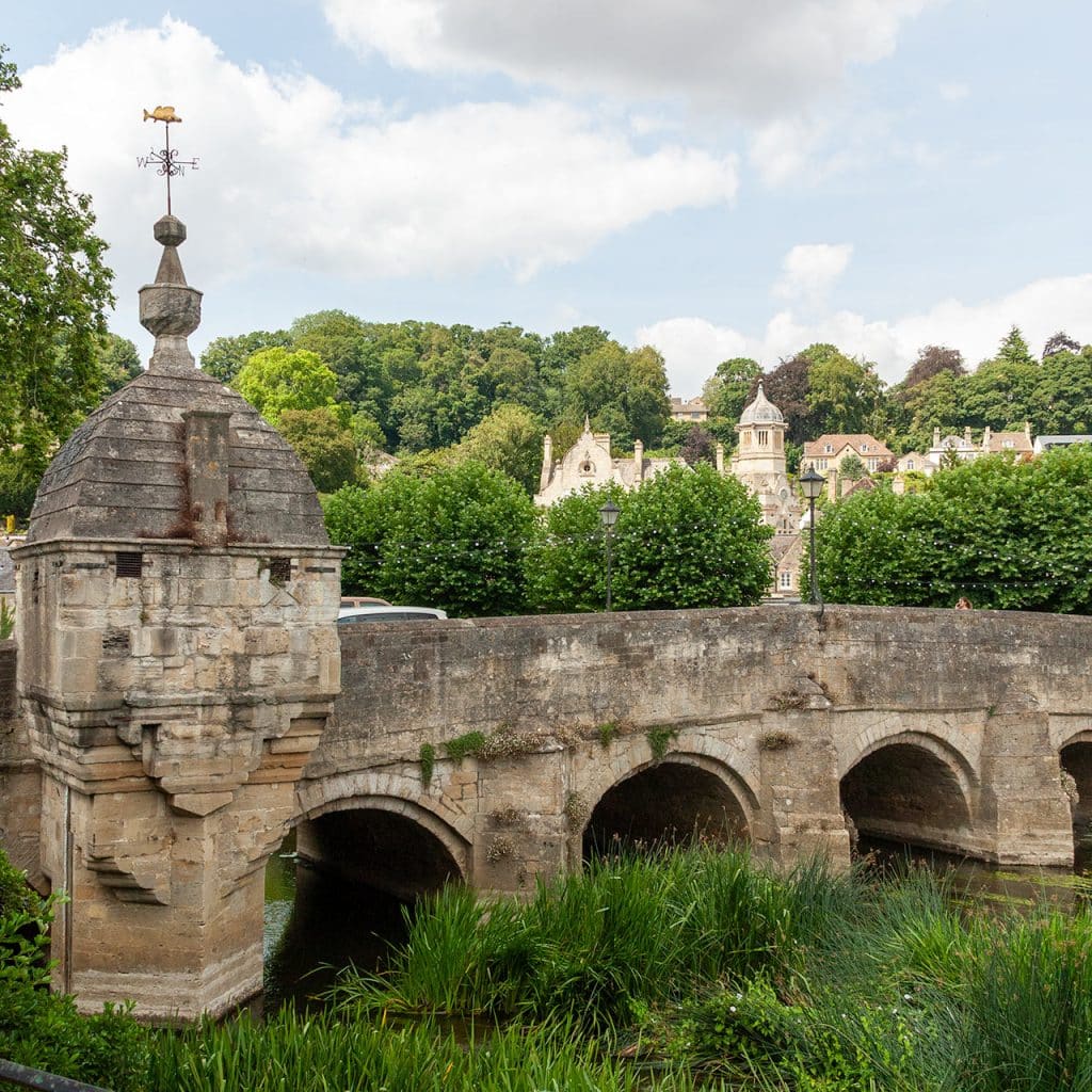
The bridge has thirteenth century packhorse origins and two arches of that date survive on the east side. It was widened in the seventeenth century for larger traffic.
The small domed building at the south end is probably seventeenth century. By the 1700s it was in use as the town lock-up, the sort of one-cell village prison known as a blind house. It may have started as a chapel to St Nicholas, whose emblem is the gudgeon that sits on the weathervane on top of it. Which gave the town the line about its prisoners being kept under the fish and over the water.
The Shambles
The Shambles is the old market street, and it was the High Street before the current one took the name. “Shambles” comes from the Anglo-Saxon scammel, a stall, and the word is associated across England with the meat trade. It is short, narrow, and the best-preserved medieval street in the town.
The Bridge Tea Rooms
24A Bridge Street was built in 1502 as a single-storey blacksmith’s cottage. The upper floor went on in 1675. It has since been a tailor’s, a blacksmith’s again, an antique shop, and since 1989 a tea room.
The old town hall, which is now a church
The building on the corner was built as the town hall in 1855, designed by Thomas Fuller of Bath. The town sold it in 1911. It spent years as a cinema. The diocese bought it in 1955 and it is now the Catholic church of St Thomas More, Grade II listed.
The canal and Avoncliff aqueduct
The Kennet and Avon Canal runs above the town and the towpath west of it is the best walk here. About a mile and a half out, the canal crosses the River Avon and the Bath to Westbury railway on the Avoncliff aqueduct: three arches, 110 yards long, a central elliptical span of 60 feet, built by John Rennie between 1797 and 1801.
Walking the towpath from the town to Avoncliff and back is a couple of easy miles on the flat, and there are more Cotswolds walks if you want something longer.
Guided walking tours
The Moulton Trust, which looks after The Hall on the Holt Road, runs guided walking tours of Bradford on Avon itself. One covers Georgian life in the town, the other the Avon Rubber factory and local industry. They go on sale a few at a time through the Trust’s website rather than running to a fixed weekly timetable, so book ahead rather than turning up.
Getting here
Bradford on Avon has a station on the line out of Bath, which makes it one of the few places at this end of the Cotswolds you can reach properly without a car. Trains run through to Bath Spa in one direction and Westbury in the other, and the station is in the town centre.
By road it is on the A363, eight miles or so from Bath and about four from Trowbridge.
More on reaching this part of the country in the guide to getting to the Cotswolds, and on managing without a car in the Cotswolds without a car.
Places to visit near Bradford on Avon
The Hall is on the Holt Road, a Jacobean house with seven acres of grounds and the place Moulton bicycles are still made.
Bath is eight miles west and is the obvious pairing, particularly by train. Lacock is about nine miles north east. Castle Combe is thirteen miles north, which makes the two of them a comfortable day if you have a car.
Further into the Cotswolds, Tetbury is around twenty miles north and Cirencester about thirty.
Bradford on Avon FAQ
Is Bradford on Avon in the Cotswolds?
It’s right on the edge. The Cotswolds National Landscape’s own literature treats the town as the southern end of the Wiltshire Cotswolds. The town centre falls outside the drawn boundary, but so does Cirencester’s, and so do Bath, Cheltenham, Gloucester and Stroud.
What is Bradford on Avon known for?
The Saxon church of St Laurence, the fourteenth century tithe barn, the weavers’ terraces on the hillside, and a cloth-and-rubber industrial history that runs from the medieval wool trade through to Moulton bicycles.
How do you get to Bradford on Avon from Bath?
By train from Bath Spa, or by road on the A363. It is about eight miles.
Is Bradford on Avon worth visiting?
For a half day, yes, and more if you walk the canal or go up into the terraces. It is a working town of ten thousand people rather than a preserved village, which means it has proper shops and it is not overrun in August.
How do you pronounce it?
As it looks. Locally it is usually just “Bradford”, or BoA in writing, and it is nothing to do with Bradford in West Yorkshire.
Avon is the name of the river that runs through the town, hence Bradford on Avon. Avon comes from the Welsh word for river – afon, so the name of the river is literally the river river.
See more Cotswold towns.